Tapaue-O-Uenuku is the tallest mountain in New Zealand outside of the Southern Alps. It lies in the Inland Kaikoura’s at the northern end of New Zealand’s southern island. Its name translates from Maori to, “the footprint of the rainbow.” Rising 2885 meters above sea level, this snow covered monolith towers above prized Marlborough wine country in the remote Awatere valley. To climbers, it was Sir Edmund Hillary’s first triumph and is a rite of passage in the hiker to climber evolution. So naturally when a mid October weather window opened, I could not put on my crampons quick enough.
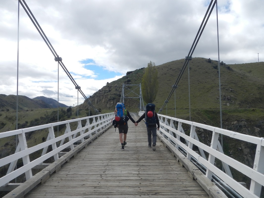
I began my journey with two fellow international students at the University of Canterbury, Max and Brayden. A 6am Friday morning departure meant a missed lecture, but like we spent that much time in class anyway. After a five-hour drive from Christchurch, we finally arrived at the Hodder River Bridge in the heart of the Awatere River Valley. The Hodder River drains into the remote Awatere and is the main route to the base of Tapaue-O-Uenuku.
Our excitement was quickly extinguished as our engine gave out the moment our front tires hit the grass parking lot. The three of us found ourselves in the middle of nowhere with a dead car and zero mechanical knowledge. It was not long before our savior driving a tiny white Toyota rolled across the Hodder Bridge. He was an upper middle aged Kiwi whose name we never asked. We just referred to him as The Old Man. It turned out he was looking to climb Tappie this weekend as well. After quick look at our car he found one of the wires connected to the battery was jerked loose on the last bump of our journey. It was an easy fix. Overwhelmed by our luck from the Old Man, we began our journey on a light foot surrounded by the sights and smells of the rolling green hills of sheep country.
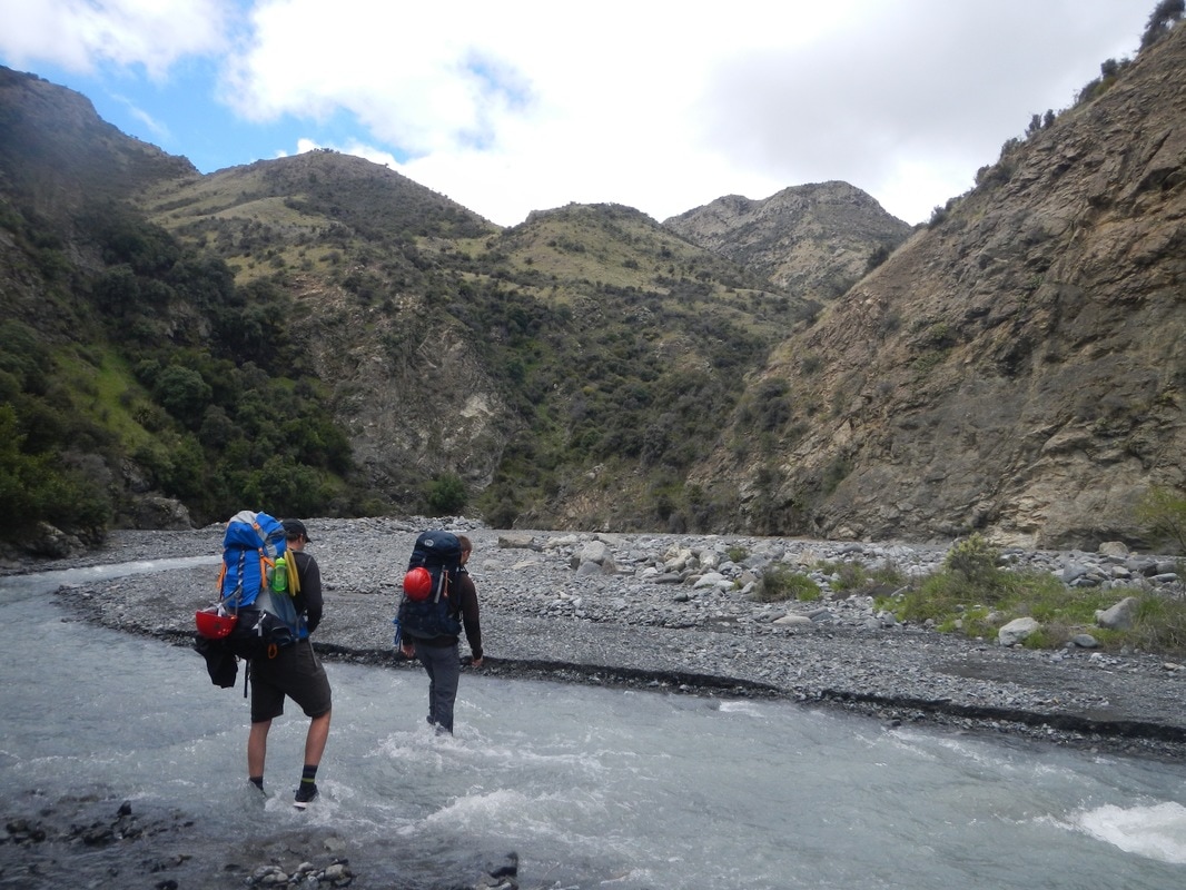
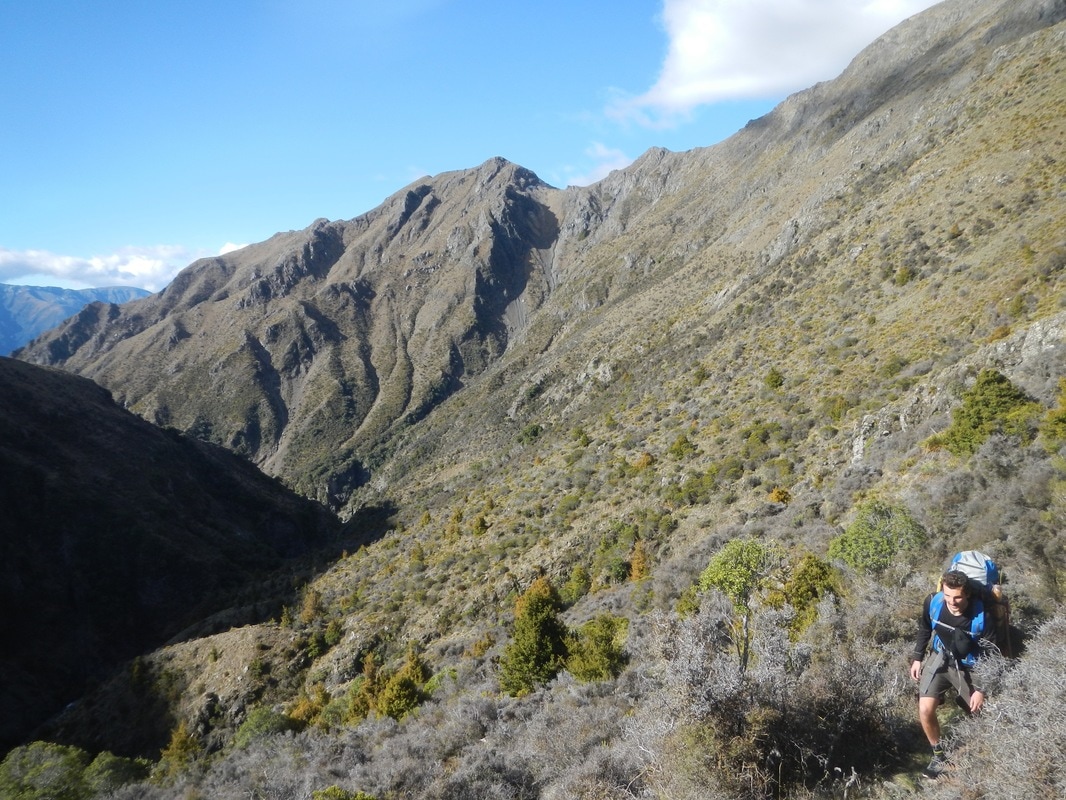
The six to eight hour trek up the Hodder River to the base of Tappie is legendary amongst Kiwis. A tramper should be prepared for 60 to 90 river crossings, and the Hodder is no lazy Monument Creek. I am talking about an ice-cold torrent that dives down 1000 meters in 15 kilometers in a narrow rock walled canyon. It is certainly a place to avoid if it is raining.
Hiking with wet feet is commonplace in the New Zealand bush. Learning from past experiences we came prepared and wore our sneakers on the approach to keep our boots dry. With cold numb feet we spent all day hiking on smooth river rocks amongst a classic Middle Earth landscape of gold tussocks and sheer rock walls.
Hiking with wet feet is commonplace in the New Zealand bush. Learning from past experiences we came prepared and wore our sneakers on the approach to keep our boots dry. With cold numb feet we spent all day hiking on smooth river rocks amongst a classic Middle Earth landscape of gold tussocks and sheer rock walls.
Three quarters of the way through our hike the canyon becomes impassable. Fortunately, punishing switchbacks up a steep slope divert us around the blockage. Back on the river it is a short eternity before we see our refuge for the night. The huts appear as a couple of specks perched high above the river in front of a dark red scree slope. We crest the final ramp in the last hour of dusk.
The beautifully maintained huts are just two of hundreds throughout New Zealand. Far above tree line there are no need for fireplaces, so we put on extra layers as darkness falls. I forgot sunglasses so I spend my evening crafting a pair out of flax, sticks, and duct tape. After a quick dinner we get to bed early to prepare for our alpine start.
We are up and away by 5:30 am under the first glimpses of dawn. After a quick descent and a final crossing of the Hodder we launch up Staircase Stream. Notorious for soaking climbers at the beginning of their summit bid, a dwindling snowpack has blessed us with a dry Staircase. Continuing up the valley guided by a few rare cairns we make our way across tussock and scree to the base of a basin below the saddle that connects Tappie to the neighboring Mt. Alarm.
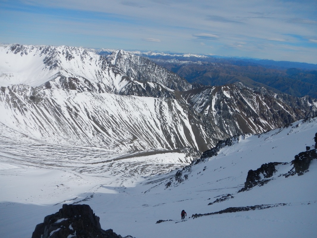
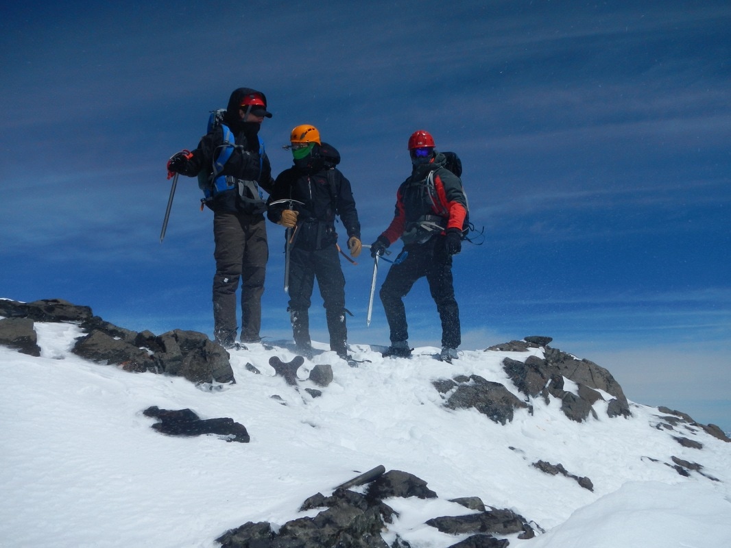
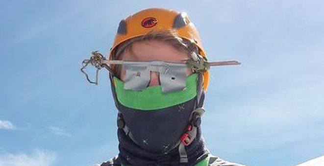
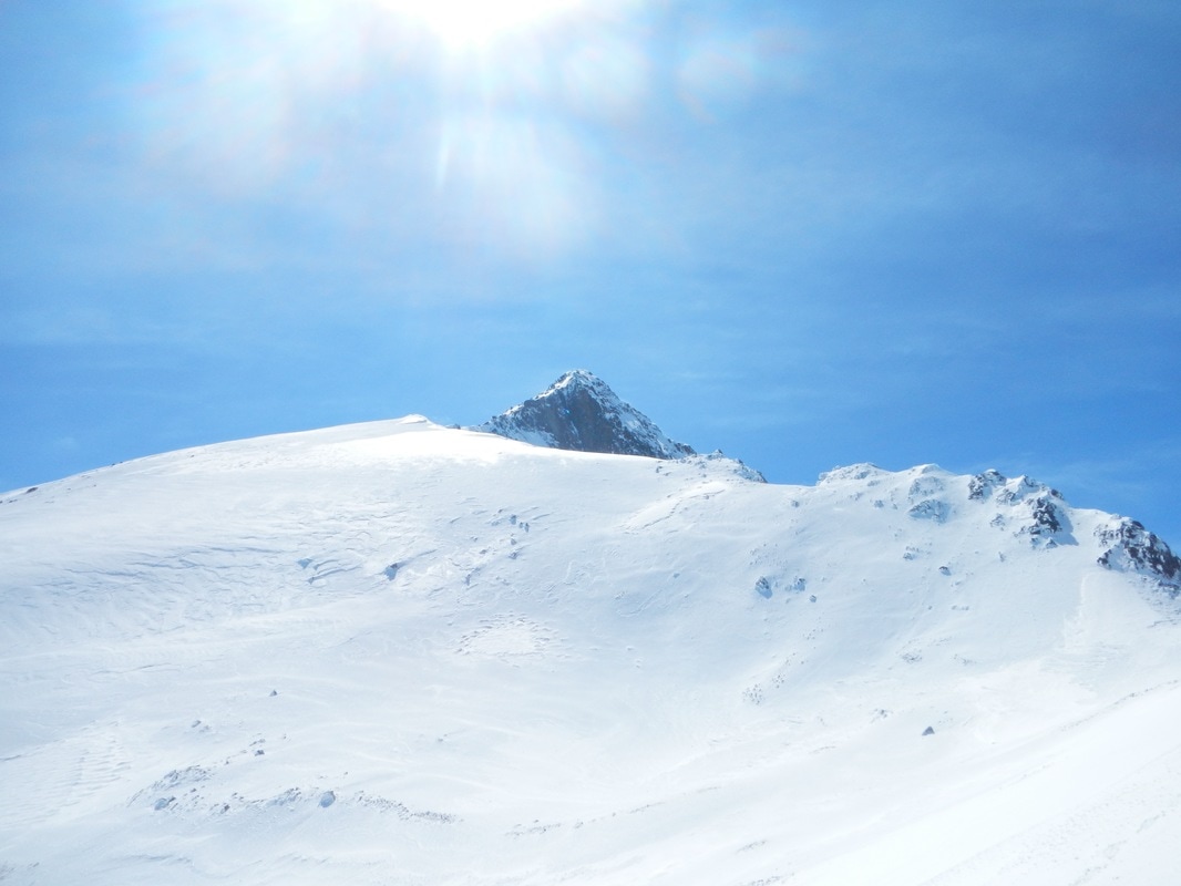
Near 2000m we reach snowline. It must have been a warm night because our boots sink in up to mid calf and we decide to forgo the crampons in the soft snow. We quickly make our way several hundred meters up the shaded snow slope with small rocks and bits of ice tumbling past us and the sun hot on our heels. At 2500m the snow turns to ice and its time to step into crampons. We find a narrow chute that takes us out of the main basin and into the hands of Big Yellow. The New Zealand sunshine reflects off the snow and begins a slow roast of my retinas. Excitedly, I take out my fragile sunglass contraption to test my ingenuity. I have no peripheral vision but at least I will not go snow-blind. Here we get the day’s first glimpse of Tappie’s summit. A striking snow dusted pyramid with a vertical drop to the south.
As we begin our climb up the summit ridge my finicky sunglasses lose purchase on my face. I remove my helmet to make a quick adjustment. Due to my tunnel vision I knock my helmet off my pack and watch its careening escape down the slope. It comes to rest 100m downhill on a flat patch of snow. It could have been worse. I look up to see Max balanced above me with a concerned look on his face. I make a quick glissade to my helmet and am back on the ridge within minutes. Who do we find on the ridge? The Old Man. The four of us take turns leading a spectacular alpine ridge. Hard ice and steep drop offs keep us focused but nothing technical. Too soon we run out of mountain.
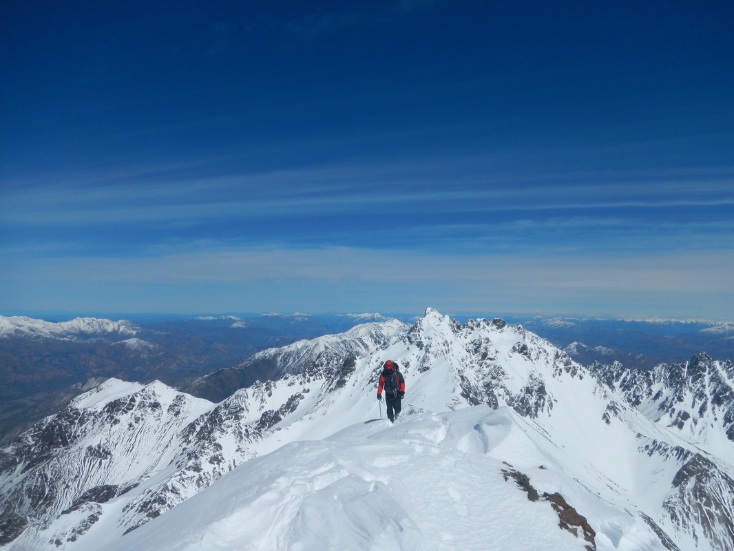
A perfect view on a perfect day! To East, West, and South lies the folds of innumerable mountains. To the North past the Cook Strait lies the North Island and the capital city Wellington. Meanwhile the wind is vicious. The cold air is blasting through our clothing and freezing our bones so we hide behind a rock to eat our lunch. Afer some quick photos and got on with our descent. Heaps of glissades and a nap in the afternoon sun brought us back to the huts around 6pm. Ending a short 12 hour day and an unforgettable weekend.